Riparian Vegetation
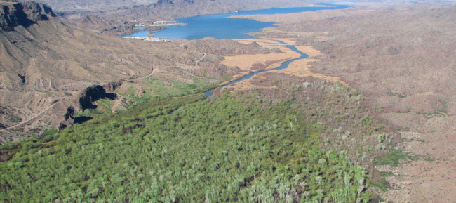
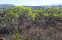
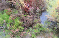
Much of the interest in the Bill Williams River (BWR) ecosystem stems from the lush riparian vegetation that grows in many locations within its valley, a striking contrast to the adjacent, sparsely vegetated uplands. Riparian vegetation along the BWR is dominated by several woody species common to low elevation southwestern riparian ecosystems, including Fremont cottonwood (Populus fremontii S. Watson), Goodding willow (Salix gooddingii Ball), saltcedar (Tamarix ramosissima Ledebour), seep willow (Baccharis salicifolia (R. & P.)), and mesquite (Prosopis spp.) Herbaceous vegetation tends to be quite sparse, except adjacent to areas where water and light availability are high. The herbaceous flora comprises the greatest plant diversity along the river. Riparian forests along the BWR provide habitat that is valuable to a great diversity of animal species.
![]() Fish & Wildlife of the Bill Williams River
Fish & Wildlife of the Bill Williams River
 |
||
 |
 |
 |
Research on the BWR revealed that periodic floods and summer base flows are key flow components that influence riparian vegetation abundance (Shafroth et al. 2002). Large magnitude floods can remove vegetation and produce bare sites for new growth, and likely did on a fairly regular basis historically. Riparian vegetation growth and survival can be limited by periods of very low flow that do not provide sufficient moisture or replenish alluvial ground water sufficiently for the relatively water-demanding riparian plants, especially during typically hot and dry parts of the growing season (e.g., May-September; Shafroth et al. 2000). Conversely, periods with higher low flows during the growing season, or occasional pulses that replenish soil and ground water can enable relatively high growth and survival of riparian vegetation.
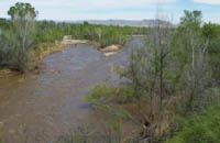
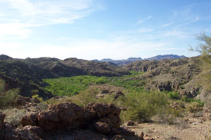
Vegetation patterns are also influenced by local geomorphology, which conditions flood flows and the availability of groundwater. Along the BWR, there is a mix of canyon and valley reaches. The canyon reaches tend to have narrower floodplains, a less complex arrangement of channels, and shallower groundwater tables. The valley reaches may have multiple channels, a broader floodplain, and, especially at the upstream ends, lower groundwater tables.
 |
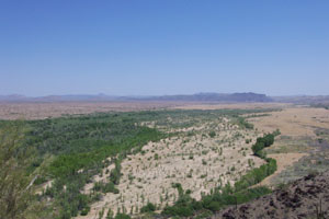 |
Photos of examples of a canyon reach (left) and a valley reach (right) |
|
![]() This site was constructed by the U.S. Geological Survey Fort Collins Science Center
This site was constructed by the U.S. Geological Survey Fort Collins Science Center